
Real-time event site map
Give organisers and staff a live operational view of the entire event site. Track layouts, infrastructure, facilities and operational planning items from one connected interactive map.

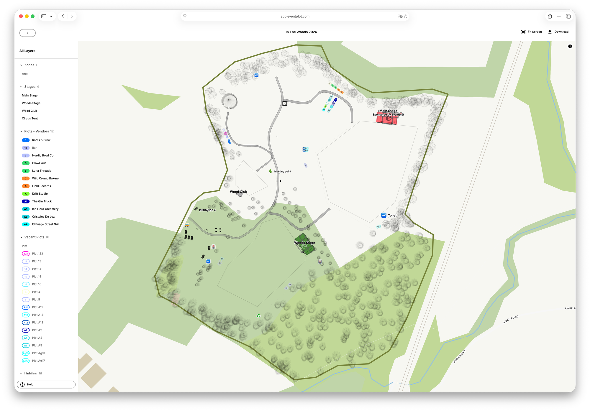
The Eventplot site map gives organisers and event staff a live operational view of the entire event site. Instead of relying on disconnected PDFs, spreadsheets and messaging threads, your layouts, infrastructure, facilities and operational planning items stay connected in one interactive map.
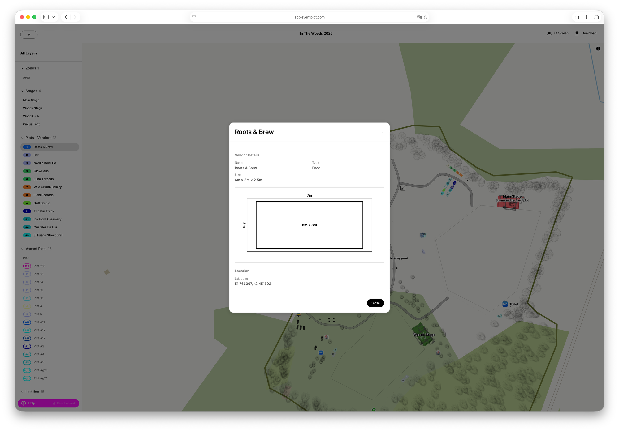
Operational items added during planning automatically appear within the live site map, helping organisers and staff coordinate infrastructure, access routes, facilities and event operations from one connected workspace.
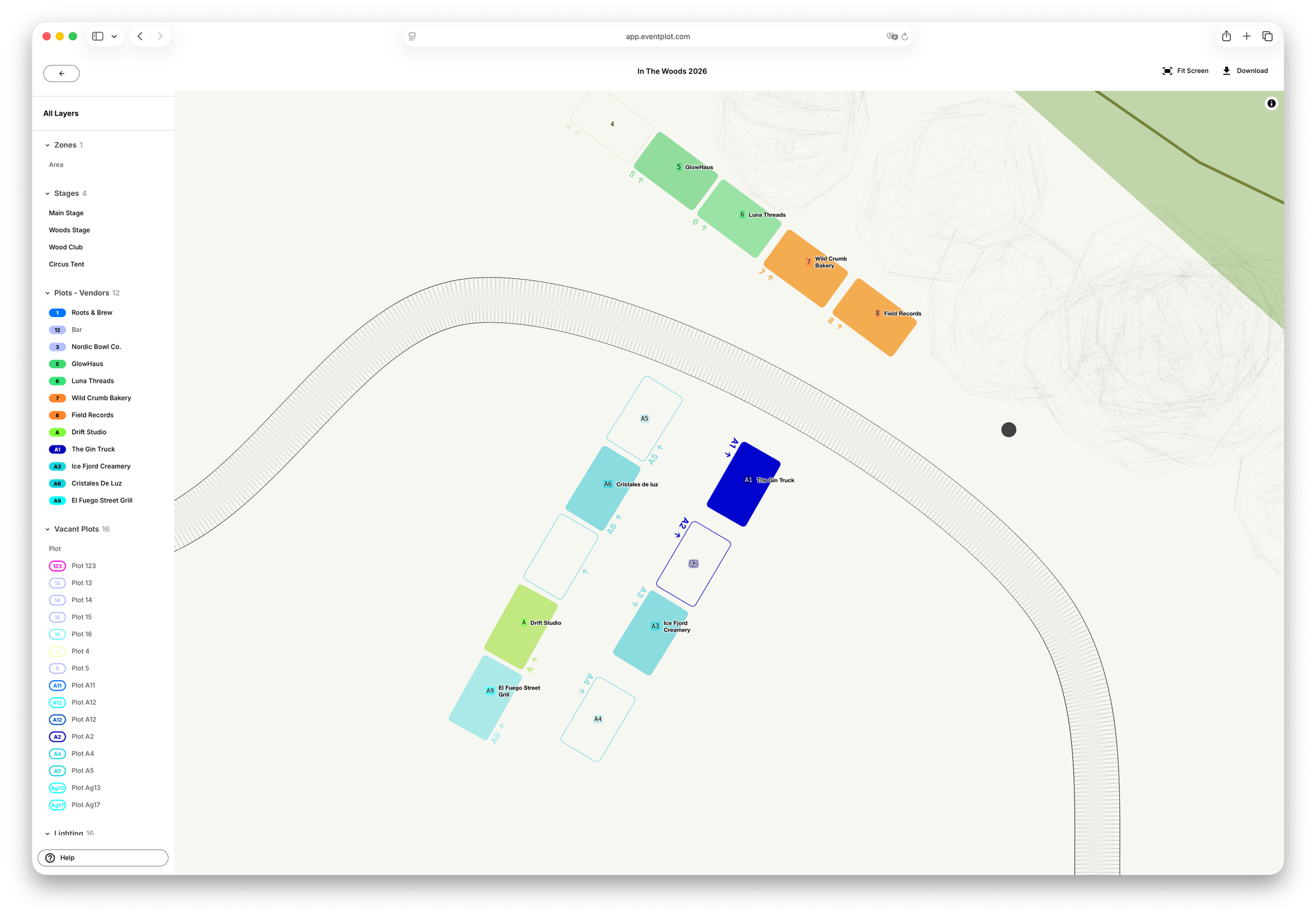
- View stages, vendors, facilities and infrastructure in one live operational site map
- Keep layouts and operational information automatically updated
- Coordinate organisers, staff and stakeholders from one shared workspace
- Track access routes, operational zones and infrastructure visually across the site
- Operational planning items automatically sync directly to the live site map
Built for real outdoor events and festivals, the Eventplot site map helps organisers coordinate complex event sites more clearly and efficiently. Everything stays connected, visual and easy to update — reducing confusion and helping teams spend less time chasing information and more time running the event.


