
Publish a live interactive 3D festival map
Give attendees a live interactive view of your event. Explore stages, vendors, facilities and schedules in one clear, easy-to-use event map.

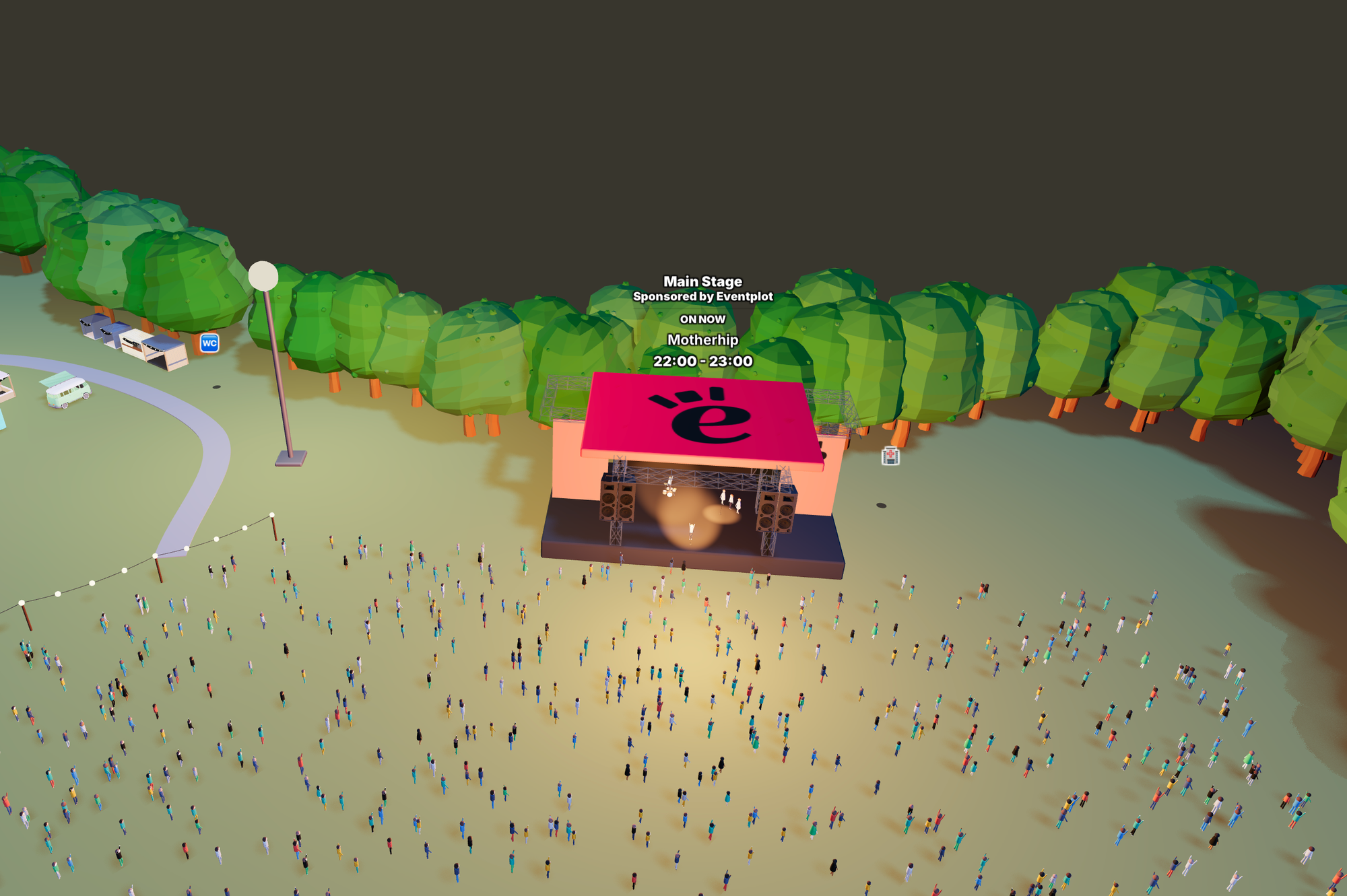
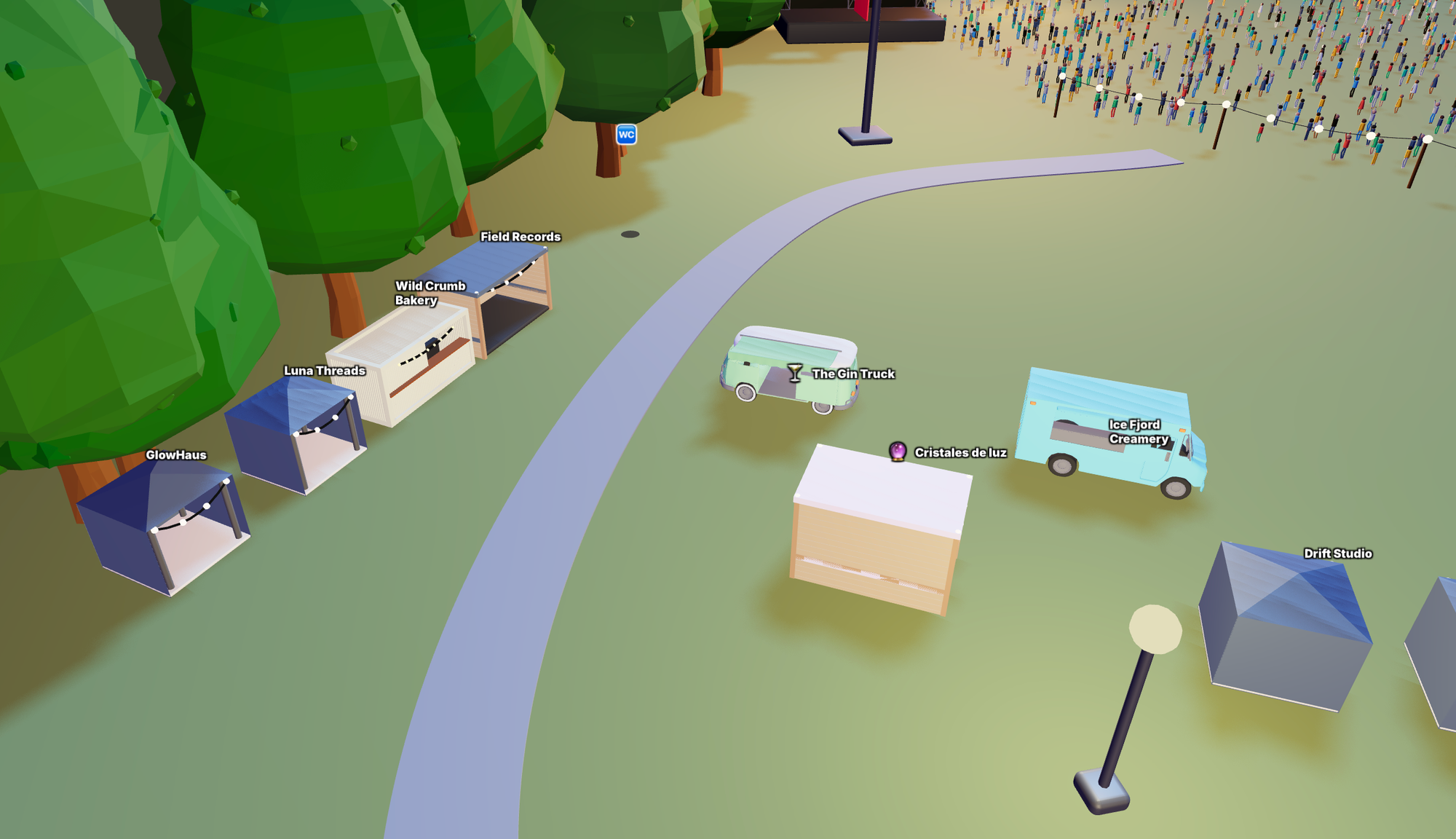
The Eventplot public map turns your site into a live interactive experience. Instead of static maps or outdated PDFs, visitors can explore your event in real time — finding stages, vendors, facilities and live schedules instantly from their phone.
From food trucks to performances, everything stays connected and automatically up to date throughout the event.
Features
- Explore stages, vendors and facilities in one live interactive map
- Tap locations to view schedules, information and updates instantly
- See what’s happening across the event in real time
- Show live attendee location directly on the map
- Help visitors navigate large festival and event sites with ease
Built for real outdoor events and festivals, the Eventplot public map makes events easier to explore, reduces confusion and helps attendees get more from the experience.
Explore a live example of an Eventplot-powered event website. “In The Woods” shows how your planning data becomes a fully interactive public experience — complete with live maps, stage schedules, vendors and automatically updated event information.


